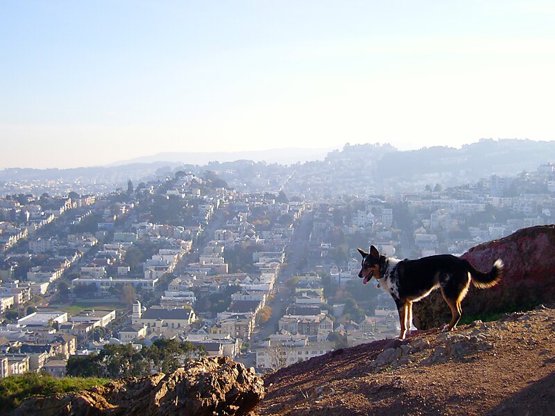
Corona Heights Park is a park in the Castro and Corona Heights neighborhoods of San Francisco, California, United States. It is situated immediately to the south of Buena Vista Park. Corona Heights is bounded in part by Flint Street on the east, Roosevelt Way to the north, and 16th Street to the south. The base of the hill is at approximately 300 feet, while the peak extends to 520 feet above sea level.Corona Heights Playground and the Randall Museum are located within the Corona Heights Park. The whole area is underlain by Franciscan chert bedrock, and a large percentage of the hill is barren. At the hilltop, the chert bedrock in terra cotta red is clearly visible. The steps leading up to the peak are not supported by handrails. The peak of the hill is windy, but it offers an unobstructed panoramic view of the city of San Francisco from downtown to the Twin Peaks.
Download Download See moreDaily: 5 am - midnight
Wikipedia https://en.wikipedia.org/wiki/Corona_Heights_Park
Official website http://sfrecpark.org/destination/corona-heights-park/
Phone +1 415 831 5500
Address Roosevelt & Museum Way San Francisco, CA 94114, USA
Coordinates 37°45'53.589" N -122°26'21.724" E