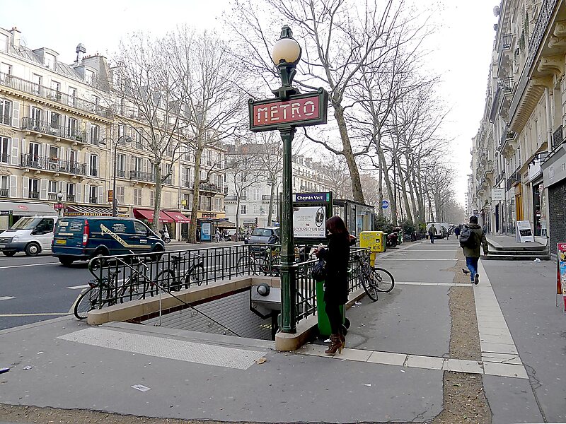
Chemin Vert is a station of the Paris Métro on Line 8, named after the Rue de Chemin Vert.
It is located in between Bastille station and Saint Sébastien - Froissart.
The station opened on 5 May 1931 with the extension of the line from Richelieu - Drouot to Porte de Charenton. The Rue de Chemin Vert follows the route of an old footpath through the middle of market gardens. In 1868 the Rue de Chemin Vert was extended from the Rue des Amandiers-Popincourt to the Barrier des Amandiers, a gate on the former Wall of the Farmers-General.
In 2011, 1,448,436 passengers entered this station.Nearby are the Canal Saint-Martin and the Place des Vosges.
Wikipedia https://en.wikipedia.org/wiki/Chemin_Vert_(Paris_Métro)
Address 63 Boulevard Beaumarchais, Paris 75003, France
Coordinates 48°51'26.819" N 2°22'5.192" E